Hikers guide to Ikaria
 Comments(3)
 a disclaimer straight off the bat… this is by no means a comprehensive guide to hiking trails on the island. Merely an introduction if I may be so bold to call it that. For some really great info you could do a lot worse than check out:
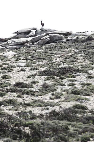
lone scout goat
“the guide”
Ikaria has a surprisingly straightforward and well-marked network of hiking trails. Which is quite remarkable on an island that isn’t really known for its commitment to develop tourist infrastructure and the locals (apart from shepherds and goats) aren’t into hiking all that much.
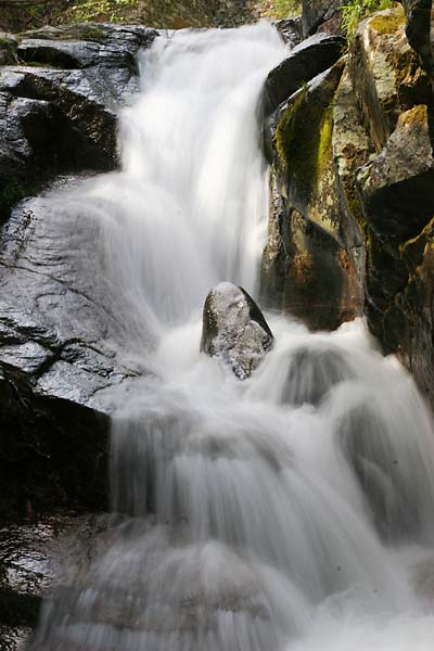
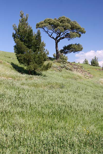
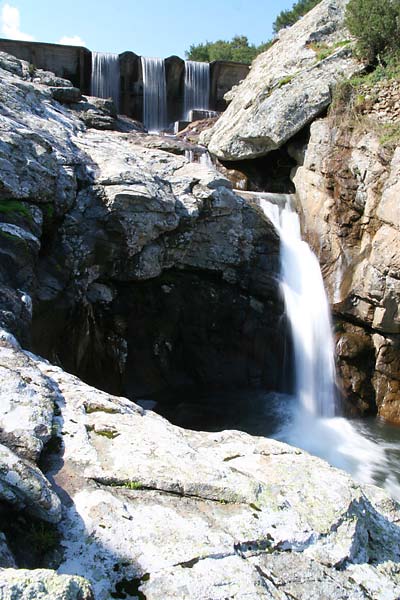
The island itself is indeed perfect for days of hiking pleasure with lots of vegetation, deep river valleys with plenty of hidden, refreshingly cold (and clean) water pools, relatively level top plateaus and a ridge line that climbs up to about 900-1000m above sea level and nice beaches to end the walks.
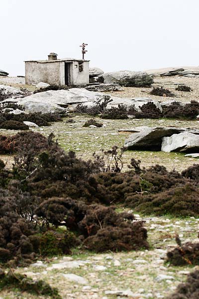
Trails can be found throughout the island however you’ll find them to be most extensive around the Rahes area.
Round of Rahes
It is my understanding that most (if not all) of the trail marks, maps and descriptions are a labour of love by one man in particular (don’t kill me if I’m wrong though). I haven’t had the chance to meet him just yet but the French team (doing a research on goat overgrazing) found him most enjoyable to talk to.
The Round of Rahes, as it is known, is an interconnected network of trails that can keep you occupied for as little as 30min or several days. Once you find one of the trail marks you can simply follow them from one to the next and see where that takes you. Or you can obtain a trail map (illustrated, not to scale) that has excellent descriptions on the back and actually plan where you’re going.
The trail map and marks are more than enough to navigate on trails however you might also get yourself a copy of the 1:50.000 map of the island. Topographic and road maps of the island are exceptionally, hopelessly useless when it comes to actually finding your way on the roads and trails since hardly any of them are mentioned (and I’ve looked at nearly every map available) but they do give you a better sense of scale, distance and shape of the landscape than the illustrated map alone.
Why most of the back roads (and even some asphalt surfaced roads) are not present on the topo and road maps is somewhat of a mystery but as far as I can tell, a lot of the roads on the island were built illegally and thus officially don’t exist. It does make it a bit of a navigation issue when you find yourself walking (or driving) on a perfectly decent road but (since you’re new on the island) have no idea where you’re supposed to be on the map (and take a wrong turn or two). That’s why it is best to keep your eye on the trail marks, read the trail descriptions and compare features across several maps.
Some might actually be surprised to find different names for the same feature but just accept this as a fact of life on Ikaria… to be fair, some of the problems also come from the fact that the Greek alphabet and pronunciation doesn’t always translate well into Latin alphabet.
trail marks
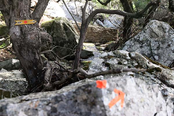
Trail marks come in a variety of styles that will be instantly familiar to most people used to walking around in the Alps. Most common form is the red dot on rocks or trees. Also popular are arrows and signposts, sometimes they may feature names and distances (in hours), sometimes just a red footprint and the direction. On the top plateaus with scarce vegetation and many, many rocks these things become less obvious and less visible (how do you see a small red dot on a rock within thousands of rocks and no clear or many goat paths to confuse you?) Since without vegetation you can see over long distances it won’t be the red dots you’ll see first but small stone piles. You might wonder how, among all the rocks, it is possible to see a stack of stones that look like all the rest but they are so clearly man-made that they usually stand out and it is not difficult to follow them.
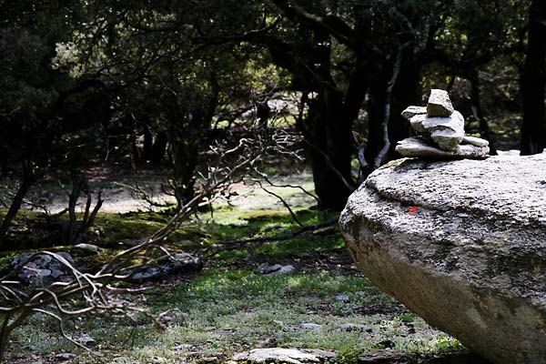
rock cairn
Sometimes these piles fall apart due to environmental or other reasons (I try my best to rebuild them whenever possible) but it is still a relatively obvious mark.
lost on an island
In case you do get lost (and you most likely will at some point since goats make lots of trails that look exactly like the one you’re supposed to be on) just make your way back to the last red dot and take a look around you. More often than not you’ll find the next one within sight (just not where you though it should be). Sometimes you might have to walk around a bit to see one but inevitably it is somewhere in the vicinity.
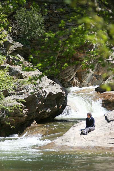
to end the hike
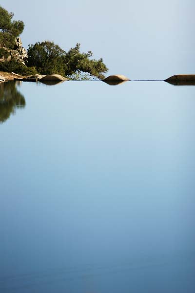
lower Vathes reservoir
My first choice will always be a dip in the water, whether sea or a river, but you just might stumble upon a nice cafeneio, taverna or even a panagiri (sp?) during the summer. Cafeneios here are certainly a destination on their own, how could they not be when some haven’t changed the tiniest bit since early 20th century (you could easily claim the same about the clientèle, I think some men have actually grown into to their chairs).
new photos in the gallery