I’ve been totally neglecting this site for the past half a year. For some reason or another I don’t find anything worthwhile to write about or I do but then I change my mind and so we go back full circle. So perhaps it’s time to make a little summary of the past few months…
Nothing much happened after the summer road trip to Portugal. At least not worth talking about… Eventually we had a Finnish Xmas in Tampere and a wedding on new years eve near Lahti.
walking on ice towards the western tip of Enonsaari island on lake Vesijärvi.
Lasse & Johanna at the end of a not quite typical beach wedding photoshoot, overcast -10°C & light snow, Pikku-kukkanen lake near Lahti
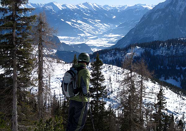
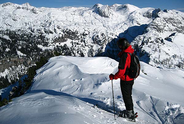
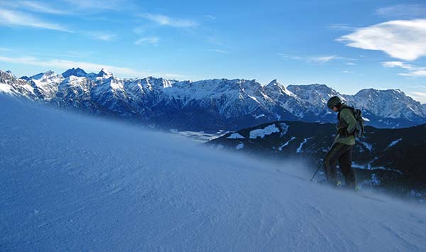
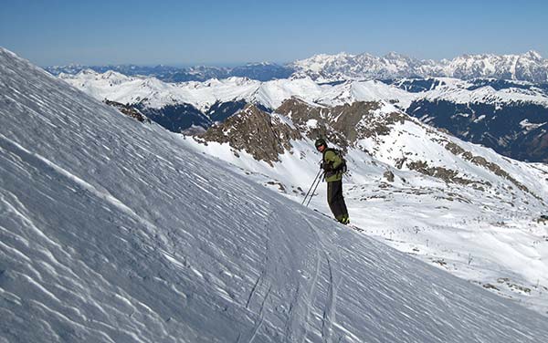
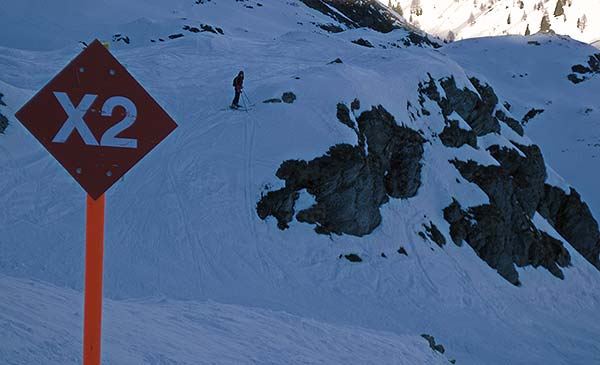
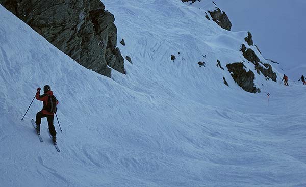
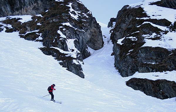
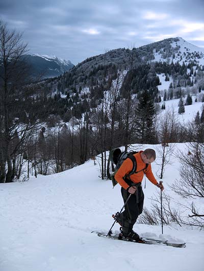
Afterwards we had ourselves a quick summer in the middle winter ski trip to Austria. Tauplitz, Saalbach-Hinterglemm-Leogang, Zell am See-Kaprun and Zauchensee on an extremely warm prolonged weekend. No powder to be found anywhere… just the hard packed reality of a lousy winter. We based ourselves at a small bio bauernhof. Nicely priced, convenient location with lots of great skiing within an hours drive and friendly.
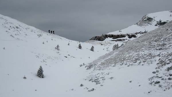
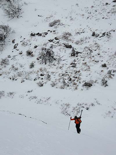
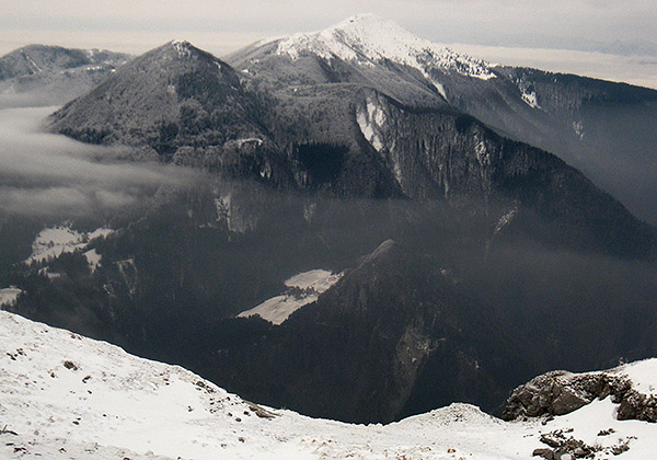
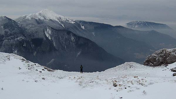
On occasion we managed to get out, do some winter hiking and the like. The photo below is from a ski touring escape, there and back before lunch type of deal.
Mixing business and pleasure in travel is something that doesn’t always work but something I try to do as often as possible nevertheless. If nothing else it takes the edge off the boring A to B business travel. There are certain complications, mixing scheduled and unscheduled mindset is just one of them, but at the same time it gives you a rough outline of what you’re doing and where you’re going which can be a good thing (sometimes).
Eventually we made it to Avanca (near Estarreja/Porto) where the AvancaCinema conference was held in a small primary school (that was a bit of a surprise to say the least). Things run slowly in some parts of the world and when we got there (on time) most things weren’t even ready yet. So we took off on a hunt for a campsite on a beach as close as possible. We found one in Furaduro which I guess is a typical summer holiday town next to a long stretch of sandy beach with decent waves coming in.
on the beach at Furaduro, near Porto
The conference itself was partially interesting, if nothing else it blew away many preconceived ideas I had about academia and it should take the edge off when I attend the next one. And to further demonstrate how slowly things run, it’s now the end of November and the conference proceedings still haven’t been published even though they’ve promised them first by the end of August, then by the end of October, then….
cliff near Sanxenxo, Galicia
So rather than hang around for longer than it was absolutely necessary (they did have some amazing cakes at the opening dinner) we chose to take off. Not to the south of Portugal as originally planned (will have to wait for some other occasion) but north through Galicia to the bay of Biscay, Picos de Europa NP, the amazing Guggenheim museum in Bilbao and Biarritz/Anglet for some surf scouting.
Dentelles really are an amazing place to climb. A long, serrated, narrow saw of limestone jutting out of Côtes du Rhône vineyard country. Perfectly oriented so that you can either climb on the sunny or shady side of the rock, depending on the season. There is one drawback though. The wind. The maestral/mistral making its way down to Rhone delta can get up to such speed that it can make climbing a bit of a problem. At some point I felt like I might be pulled off the wall and my glasses were shaking like a flag in the wind. So violently in fact I could hardly see. I was stuck in a relatively comfortable position with decent holds on a 5b route but I knew it would be a bad idea to continue. So I aborted, leaving one biner in the wall as a souvenir for someone who finds it.
Dentelles de Montmirail
All in all we did 6555km in two weeks. The kind folks at Citroen Merlak rented us a Berlingo for a price well below the normal rate for which I am extremely grateful. In return we made a proper test drive which revealed some issues I have with the car. The first and foremost being the lack of 6th gear. With the number of motorway kilometres we do in a typical week it would be essential. At an average speed of 69km/h on everything from motorways to mountain roads we got by on 6.1 l/100km (38.6mpg) of diesel. Not bad, but not that great either by my expectations. Simply closing one rear view mirror at 130 km/h will give you a half litre improvement. It has to be said though, those mirrors are amazing while reversing. As is the space the car offers. Perhaps too much for most people, but it sure is comfortable if you’re on the road and living out of the car.
In early June I attended a seminar at Reykjavik University (they left a brief but outstanding impression) however I wasn’t going to let this opportunity go to waste by simply staying in Rvik for a week. Nope, not me. That’s why we left a week earlier to do at least a brief tour of Iceland.
passing Fellsendavatn lake on F228 (Veiðivatnaleið)
Geysir supplied the car at a very decent price and we did the rest. Initial deal and the reason we chose them over all the other rental agencies was simple… they have Lada Niva in their lineup. Forgetting for a moment that it’s the cheapest 4×4 (and 4-wheel drive is the only way to drive in Iceland) it’s also very capable off-road. It is by no means a softy SUV but a serious car. When we got to their office (conveniently located 500m from the terminal in Keflavik) we were in for a surprise. Turns out all the Nivas were out so they offered a Hyundai Santa Fe as a free upgrade. A bit of a bittersweet upgrade in my mind. Santa Fe isn’t what I’d normally call an off-road vehicle. It’s an SUV for people who need a 4-wheel drive car to travel the 100m of gravel road to their summer cottage and to feel superior in normal city traffic. It doesn’t have low range, it doesn’t have diff-locks and it has electronically controlled 4-wheel drive. In other words a fully inflated softy. You can imagine why I was disappointed at first. However it has its upside… with rear seats folded flat we could comfortably sleep inside and not bother with the tent (we just had to accept it as dead weight in checked luggage).
Near Eyolfstaðir (F9669) in Fossarvik/Berufjorður
So there we were… sleeping and driving (on road) in style, comfort and fuel efficiency but with off-road limitations in mind at all times. As it turned out many highland tracks were still closed due to melting snow so whatever was open at the time was also negotiable with the Santa Fe (mostly).
In total we drove 3500km (2200miles) in 8 days with fuel consumption at 8.1 l/100km (~29mpg) and an average driving speed of 58km/h (~36mph). Why are these numbers important? Considering the speed limit in Iceland is 80-90km/h and fuel consumption on the road was under 7 l/100km it’s indicative of what kind of roads you get once off paved roads. While the speed limit on gravel roads in general is 80 km/h you’ll rarely reach it in reality. That’s why ETA estimates on the GPS are somewhat of a joke. For instance it might tell you that it’s possible to drive from Gullfoss to Hveravellir hot springs on the F35 in about an hour. Well… multiply that by 2 or 3 for the real time needed on what’s actually a quite decent road.
chasing midnight rainbows near Afangagil
My original idea was for us to stay in one area for the whole week, do some multi day hiking and not drive around all the time. But highland road closures and the lovely Eyafjallajökull eruption (more accurately the consequences of it) changed that plan a bit. We couldn’t get close to places where we wanted to hike so had to settle on driving as close as possible. And eventually that turned into driving around the whole island with multiple highland incursions and weird roads that weren’t really roads.
But those roads get you to some amazing locations. You drive through a black desert in the middle of nowhere and suddenly there’s a bunch of lakes in front of you. With massive numbers of mosquitoes, nesting birds and just stunning scenery.
Stora-Fossvatn lake
OFF-ROAD
We certainly pushed the Hyundai to its limits, including water crossings around and possibly over its maximum allowed depth of 50cm. However, a few situations will remain in memory for a long time. The first one was on the very first day (or perhaps night if arctic midnight could be called a night) when we were driving towards Þorisvatn on a track parallel to the main highland road F26. We got on it because we were hoping to find a place to sleep nearby. The trail got gradually worse, the tire tracks gradually disappeared and we were eventually driving inside a dry river bed, with very soft, wet volcano sand and steep sides. Stopping wasn’t an option as we would get stuck in the sand. Simply going forward was one alternative but since we only saw that track on the GPS (and at that point we had no idea how accurate it might be and that it would lead us somewhere) and seeing how we were getting deeper into unexpected, unprepared and untested trouble I wanted to turn around as fast as possible even as we were going uphill. Easier said that done as the saying goes… the sides were cut quite deep into soft sand and the channel itself wasn’t wide enough to turn. That meant I had to somehow bump the car onto higher terrain, hoping we wouldn’t get stuck in an even worse position and even deeper or softer sand. Thankfully I kept enough momentum to get it up and over, make the turn and back into the channel. We got out of it and I only wish that I could have it all on camera. But I don’t as neither of us was prepared for it and I certainly wasn’t going to repeat it.
Is this the trail? Afangagil to Hraunin
Another little off-road challenge was a short (100m) hill climb. Basically a shortcut next to a main highland road designed for ego boosting of Icelandic monster truck drivers and to frighten their paying passengers. Well… the Santa Fe almost made it to the top, had to back off only due to clearance issues crossing a ditch running perpendicularly across. I had to reverse before turning around half way down which was much harder than going up. I felt a bit disappointed afterwards, since that ditch was the only major obstacle but only until I saw how one of those huge monster trucks came to an embarrassing halt even lower down the slope. Granted he made it up in the second try but it sure felt good to see him fall flat on his face right in front of our softy.
The third off-road memory will be of us facing a river channel and the GPS telling us the trail continues on the riverbed about 20km upstream. Up to this point we crossed a few small streams and halfway across the wide riverbed with several shallower channels. When we got to the main channel it dawned on us the trail doesn’t cross all the way to continue on the other side. Seeing how the albeit narrow channel was way too deep for comfort (and without a second vehicle it would probably be a very costly lesson) and how we had no idea where and how the trail continues beyond what we could see we beat a retreat. The car was certainly out of its comfort zone in such terrain, a rock strewn riverbed and deep water.
F2208 continues through there
WATER EVERYWHERE
At this point you might think Iceland is all about off-road driving. To a certain extent, for me, yes. I have never seen so many huge cars with huge wheels driving over such demanding terrain. But there’s more to it. You could do it all on horseback. The country is beautiful, full of contrasts over short distances. And full of horses, birds and waterfalls. It’s funny how most tourists only bother to see two or three well known waterfalls when there’s 10 equally or more impressive around the corner. Actually all those waterfalls contributed to “waterfall fatigue”. Eventually you just don’t notice them any more. Something that would be hailed as a natural monument and a big attraction in many other countries just fades into the background and you begin to wonder if it’s worth stopping to take a closer look.
Dettifoss was one of them. By the time we got to the north of the island we really couldn’t be bothered any more. But it was on our way, another reason to turn off the main road, so we stopped. For dinner. The weather was miserable but I went down to the edge to shoot some video and photos while Jonna got the pasta ready. And below is the result.
HIKING
Snæfellsjökull approach from the east on Jökulhalsleið (F570)
We didn’t do as much hiking as I hoped in the beginning. We were there too early in the season and getting to certain trail heads was out of the question. So we took whatever we got. Every day we took at least a short walk to break the monotony of driving, to get away from the roads and to just enjoy the scenery.
Snæfellsjökull climb, Stapafell (521m) in the background
I’m constantly amazed, but I really shouldn’t be any more, how random hikes towards somewhere that doesn’t look all that promising at first sight lead to interesting discoveries. Geldingafell was such an example… it didn’t look like much. Especially compared to the scenery around it. Bláfjell on one side, the impressive Insta-Jarlhetta group and Langjökull on the other. But with changing weather, no preparation and no real climbing gear it would be foolish to attempt either of them. Bláfjell was inviting but we chose the much lower Geldingafell for a short and safe introductory walk. Once on top we were treated to an amazing view towards Hvitárvatn and beyond towards the interior of Iceland. But also right there, inside a depression, was a small lake on top of melting snow. Haven’t seen that before…
Hengifoss from above
I also discovered an old cairn marked trail running on the ridge above Hengifoss. I was watching this 118m beauty from below (where most people see it) and decided I needed more exercise before lunch. So I found a way up to the top to get a closer look and there was a trail that didn’t seem to be used very often. But the view was much nicer from up there… As was the view from the top of Snæfellsjökull. This 1446m glacier covered volcano sits at the end of Snæfellsness peninsula. On a good day you can admire it all the way from Reykjavik. As we discovered it’s really popular with snowmobile riders (understandably so) and there’s a snowmobile trail leading to the top. We took a slightly different approach. We noticed an old ski lift running halfway up the slope. It was also the approach with what looked like the least amount of snow and ice in the way. Avoiding crevasses altogether was a priority for us. At first we said we’d only try to get to the lower peak right above the ski lift and avoid the glacier. There was hardly any snow to cross on the way there so it was a safe choice. But once we got to the top of that one we got a clear look at the glacier, the crevasses we’d have to avoid and the top. Which wasn’t that much further so we went for it. All in all it took us between two and a half and 3 hours from the car to the top and 20 minutes to slide down and another 10min to the car. A beautiful climb. If a bit wet in the shoes.
The rest of the photos as slideshow:
chasing midnight rainbows in Þjórsá river valley
Image 1 of 39
chasing midnight rainbows in Þjórsá river valley
 Comments(0)

")


")


")
 in Fossarvik/Berufjorður, eastern fjords")

 ©Jonna")


 approach from the east on Jökulhalsleið (F570)")
 in the background")


