Ridge walk
 Comments(8)
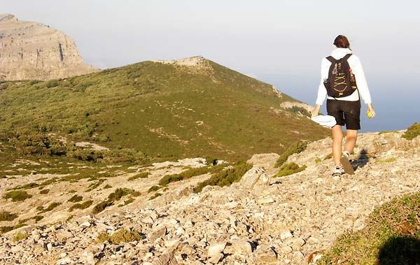
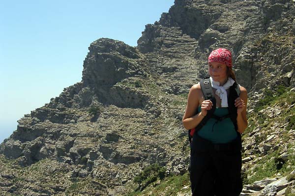
above Radi
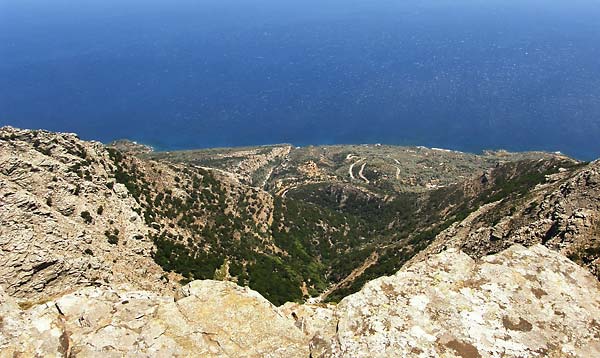
The ridge walk from one end of Ikaria to another has been an idea some of us have had pretty much since I came here back in April. It’s been discussed, considered and planned many times but never quite to the point of execution.
Johanna & Jude on mt. Melissa
Since Jude was leaving us this week, there really was no more room for delays and excuses and with my parents on the weekend visit of the island we had a perfect logistics support system. A few days before setting off we finally managed to meet with Angelos and we also discussed the walk. Hiking Ikaria group calls this a 5/6 day Swiss walk so I was slightly concerned if this route is doable in 2 days and I just needed some more information to convince myself into what I suspected was possible.
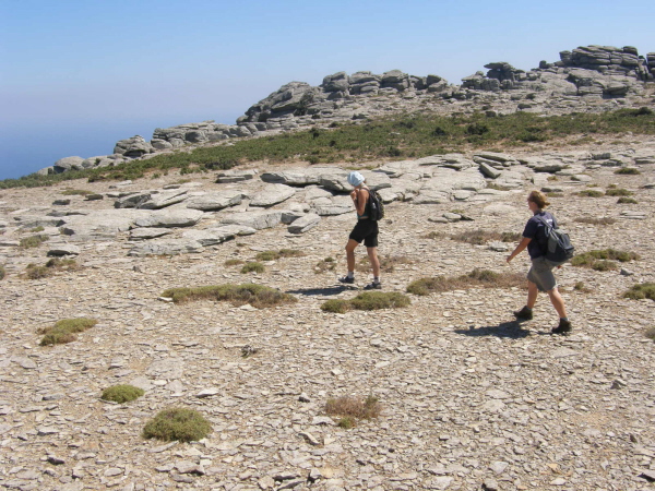
somewhere above Plagia
Since we were feeling a bit lazy we decided beforehand to skip the hard part of climbing up from Karkinagri and focus on the ridge line itself. Ag. Isidoros was to be our starting point and the windmills on the other side of the island the end. A long way off… but definitely not 5 days away.
As it turned out the route we did could actually be completed in just one long summer day. We walked 5 hours on the first day (I had to pick up my parents coming off the ferry so we couldn’t start before the afternoon) and 8 on the second. Those 8 hours were an unfortunate result of getting slightly lost (more accurately, off the correct route) between the church of Ag. Dimitrios (above Koskina) and somewhere above Plagia. Angelos suggested that there are two ways of crossing that part. One on the ridge, one below the cliffs. We chose the latter but in the process managed to end up where we didn’t want. Very low and very far off the ridge. Eventually, after a frustrating climb up (just over 400 vertical meters) over lots of thorny and spiky vegetation in the middle of nowhere, with no real trails (and surprisingly little goat activity), we got back on the ridge and continued as planned. Estimated loss of time because of the detour was somewhere between 1 and 2 hours. The rest of the walk was much more of an easy cruise though with some short sections of jumping and climbing up and down rocks.
the way up, photo by Johanna Robinson
back on the ridge, photo by Johanna Robinson
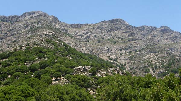
Navigation during the walk should not be much of a problem in general (ironic isn’t it?). For the most part in the western end of the island you don’t really need to follow the trail as the terrain is open and easy to walk. You may not pick the easiest or most direct route but as long as you walk in the correct general direction there should be no problems. The one part where you really need to find the trail is the section through Radi. Good luck if you don’t. You’ll be stuck in those dense trees for hours probably. We stumbled across the trail more by accident then intention. After some tough going under, over and around the trees and bushes we suddenly found ourselves on the trail and followed it out.
As we had the luxury of having someone pick us up at the end of the day we decided to travel light and not sleep in the forest. With the strong winds it would probably be impossible to catch any anyway. So we cheated (again), drove back to the comfortable beds and some proper dinner and continued from the same point the next morning.
The other tricky part can be the section the other side of the road from Radi. As mentioned previously you have two options. I can only suggest you take the one on the ridge rather than below the cliffs. If nothing else you’ll at least have a clear view of your way forward. Although, it has to be said, the cliffs are beautiful.
The eastern end of the island has a much more pronounced ridge line compared to the plateaus of the west and you’ll be able to see both sides of the island at the same time, making it a navigational no-brainer. There is one section with some trail marks (stone piles) guiding you over a slightly more exposed section. I suppose that’s the one Angelos warned us about crossing in windy conditions but even with rather strong northern winds we had on the weekend it was really straightforward to cross.
We ended the walk at the windmills (as that was the easiest and most obvious pickup point to describe) but you could easily continue towards Faros and the eastern tip of the island. It shouldn’t take more than 2 hours or so.
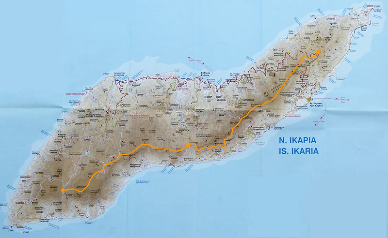
our route, click for double size
Please note this map is only an account of our route (with our unfortunate mistakes included), not the trail itself, and should not, under any circumstance, be used for critical navigation. Although the sketch was done to the best of my ability and does align quite well with the GPS waypoints I recorded it is, after all, just a sketch.
Best of the best: trail section through Radi forest, section under the cliffs above Plagia
Worst of the worst: the thorny shrub section between Zizokampos and Radi, climb back up to the ridge (as explained earlier)
Much respect to Jude for completing this walk on 1ml of water. She must have been a camel in some previous life. Huge respect for Johanna for continuing to walk around this island without any proper shoes (sandals rule!) and never complaining about thorns, spikes and rocks that must be permanently embedded in her feet by now. I don’t know how either of them did it…
 first row audience
 bald soprano
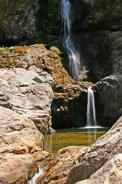 Ratsos waterfall in Chalares, photo copyright:
 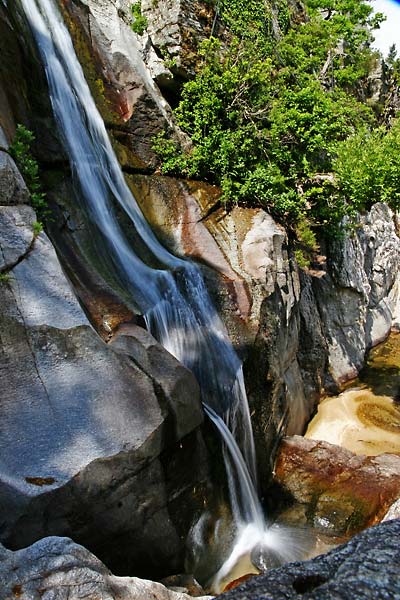 upper Raksounia waterfall, Chalares, photo copyright:
 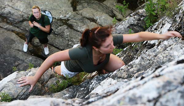 Eva & Jude climbing in Myrsonas, photo copyright:


